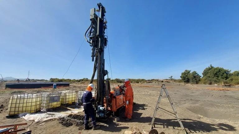
A few months ago we were on a site off Dewdney Trunk Road where a developer wanted to push a three-storey mixed-use building right up against the property line. The borehole logs from the desktop study showed glacial till, but the excavator bucket hit a lens of organic silt at two metres that no one expected. That is exactly why we run exploratory test pits in Maple Ridge—to see what is actually in the ground before the footings go in. The terrain here varies from coarse fluvial gravels near the Fraser River to dense lodgement till on the upland benches, and a single borehole rarely tells the full story. We dig at least two pits per site, log the strata against ASTM D2488, and pull disturbed and block samples for the lab. When the pit walls stand up well enough, we run hand penetrometer and pocket shear vane tests right in the hole to get a first read on undrained shear strength. Pairing the visual profile with a CPT test helps us extend the stratigraphic model beyond the pit footprint, which is useful when the bearing stratum dips across the parcel.
An open pit lets you smell the organics and feel the gravel—data that a split-spoon sample can't give you.
Scope of work
Area-specific notes
In Maple Ridge, the biggest headache we see is unrecorded fill placed during the 1960s and 70s subdivision boom—sometimes it contains stumps, boulders, or loose sand that collapses the moment the bucket teeth pull out. A test pit without shoring in that material can cave within minutes, especially after a rain. We follow the WorkSafeBC trenching requirements to the letter: slopes cut back at 1:1 or flatter in Type 3 soil, ladder access at both ends, and a spotter watching the wall the entire time the technician is in the hole. Another local issue is groundwater perched on the lodgement till surface; we have had pits in the Hammond area fill half a metre of water overnight, which tells you a lot about the need for perimeter drains if you are putting in a basement. If the pit exposes an uncontrolled fill thicker than 1.5 metres, the structural engineer usually switches to a deep foundation scheme, and that is when we recommend sampling in a footing investigation to confirm the depth to native till.
Standards used
ASTM D2488: Standard Practice for Description and Identification of Soils (Visual-Manual Procedure), NBCC 2020 Division B Part 4 (Geotechnical Design), CSA A23.3: Design of Concrete Structures (for footing bearing verification), WorkSafeBC Part 20: Excavation and Trenching
Linked services
Stratigraphic profiling and sampling
We log the exposed face in 0.3-metre intervals, photograph it with a scale and Munsell colour reference, and collect bulk and block samples for laboratory classification.
In-situ shear strength estimation
Using a hand penetrometer and torvane on the pit wall and floor, we generate immediate undrained shear strength values that help the structural engineer size footings before lab results arrive.
Groundwater monitoring in the pit
We leave the pit open for up to 24 hours where scheduling allows, measuring the stabilized water level to inform dewatering and drainage design for basement construction.
Typical parameters
Q&A
How much does an exploratory test pit program cost in Maple Ridge?
For a typical residential or light commercial site in Maple Ridge with two to four pits and basic logging, you are looking at CA$640 to CA$1,180. The spread depends on access—whether we need a mini-excavator versus a full-size backhoe—and on the sampling you request. If we are pulling Shelby tubes or running multiple in-situ strength tests per pit, the cost moves toward the upper end.
What is the difference between a test pit and a borehole for a footing investigation?
A test pit gives you a continuous, three-dimensional view of the soil fabric—you can see lenses, fissures, and boulders that a split-spoon from an SPT borehole might miss. The trade-off is depth: in Maple Ridge we rarely go past four metres with a pit, whereas a drill can reach till or bedrock at ten metres. We often combine both methods, using pits to map the near-surface and boreholes to probe the deeper bearing stratum.
Do you need a permit to dig a test pit in Maple Ridge?
It depends on the property and depth. A shallow pit under 1.2 metres on private land usually does not trigger a permit, but anything deeper or within the Fraser River floodplain setback may require approval from the City of Maple Ridge engineering department. We handle the BC One Call utility locate and coordinate with the municipality as part of our service, so you do not have to chase paperwork.