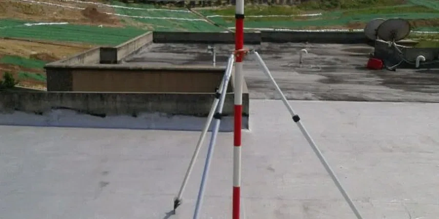
Maple Ridge sits on the edge of the Fraser Valley, where glacial till meets pockets of soft alluvial clay and the water table often rides high in the fall and spring. The combination of steep bench slopes north of Dewdney Trunk Road and saturated lowland soils creates a monitoring environment that demands constant attention. A cut that appears stable in August can shift after the first heavy rain of October. Geotechnical excavation monitoring in Maple Ridge is not just about checking inclinometer readings once a week. It involves tracking real-time ground displacement, piezometric pressure fluctuations, and vibration thresholds that could compromise adjacent structures. The team brings ASTM D6230-compliant instrumentation into every job, whether it is a shallow utility trench near 224 Street or a deep foundation pit for a mixed-use building in the Silver Valley corridor. Before the first bucket breaks ground, it is standard practice to review shallow soil stiffness with test pits to anticipate where movement is most likely to initiate.
In Maple Ridge, an excavation monitoring plan that does not account for seasonal groundwater rise is not a plan, it is a gamble.
Scope of work
Area-specific notes
Maple Ridge has grown in waves, from the early farming grid along the Haney Bypass to the newer subdivisions climbing the slopes above Kanaka Creek. Each era of construction left behind a mix of foundation types, buried utilities, and undocumented fill that complicates modern excavation. Older commercial buildings along Lougheed Highway often rest on shallow footings that tolerate almost no ground loss. When a deep excavation opens next door, even 12 millimeters of lateral movement can trigger cosmetic cracking, and 25 millimeters can compromise structural integrity. The biggest risk in Maple Ridge is not the soil itself, it is the interface between natural deposits and man-made disturbances. A monitoring program must detect movement at that interface before it propagates. This is why trigger levels are set conservatively, typically at 50% of predicted design movement, with amber and red thresholds that pause work and trigger review. The team also tracks rainfall intensity using an on-site tipping-bucket gauge, because in the Lower Mainland, a 72-hour cumulative rainfall exceeding 70 mm has historically correlated with a spike in excavation-related incidents.
Standards used
NBCC 2020 Part 4, Division B: Excavation safety and structural design, ASTM D6230-21: Standard Practice for Monitoring Movement of Soil and Rock, CSA A23.3-19: Design of Concrete Structures (shoring and underpinning provisions), WorksafeBC Part 20: Excavation and Trenching (safety compliance), ISO 18674-1:2015: Geotechnical monitoring by field instrumentation
Linked services
Deep Excavation Monitoring for Multi-Level Pits
Continuous tracking of shoring deflection, tie-back load cells, and basal heave for excavations exceeding 5 meters. Data is transmitted to a cloud dashboard accessible to the structural engineer and the site superintendent.
Adjacent Structure Protection Monitoring
Pre-construction condition surveys, vibration monitoring during rock breaking, and real-time crack displacement sensors on buildings within the zone of influence as defined by the project geotechnical report.
Groundwater and Pore Pressure Surveillance
Installation and reading of nested piezometers to verify dewatering performance and to prevent hydraulic uplift of the excavation base, especially critical during the November-to-March wet season.
Typical parameters
Q&A
What does geotechnical excavation monitoring typically cost for a project in Maple Ridge?
Most projects in Maple Ridge fall between CA$1,260 and CA$3,530 depending on the duration, number of instruments, and reporting frequency. A short-term utility trench with settlement points costs less, while a deep multi-level pit with automated total stations, piezometers, and weekly interpretation reports sits at the upper end.
How close to property lines can you monitor safely?
We routinely monitor excavations within 1.5 meters of property boundaries. Prism targets are installed on the shoring face and on adjacent structures. Total station coordinates are referenced to stable benchmarks set outside the zone of influence, typically at a distance of at least three times the excavation depth.
What triggers a work stoppage during monitoring?
Work is paused when movement exceeds amber trigger levels, usually set at 50% of the design allowable movement. The engineer of record reviews the data within 24 hours and either adjusts the construction sequence, authorizes additional support, or clears the site to resume. The process follows the observation method outlined in Eurocode 7 and is adapted to local NBCC requirements.